Showing posts with label Geography. Show all posts

Sunday, March 6, 2016

Bali

Bali is an island and province of Indonesia. The province includes the island of Bali and a few smaller neighbouring islands, notably Nusa Penida, Nusa Lembongan, and Nusa Ceningan. It is located at the westernmost end of the Lesser Sunda Islands, between Java to the west and Lombok to the east. Its capital of Denpasar is located at the southern part of the island.

With a population of 3,890,757 in the 2010 census, and 4,225,000 as of January 2014, the island is home to most of Indonesia's Hindu minority. According to the 2010 Census, 83.5% of Bali's population adhered to Balinese Hinduism, followed by 13.4% Muslim, Christianity at 2.5%, and Buddhism 0.5%.

Bali is a popular tourist destination, which has seen a significant rise in tourists since the 1980s. It is renowned for its highly developed arts, including traditional and modern dance, sculpture, painting, leather, metalworking, and music. The Indonesian International Film Festival is held every year in Bali.

Bali is part of the Coral Triangle, the area with the highest biodiversity of marine species. In this area alone over 500 reef building coral species can be found. For comparison, this is about 7 times as many as in the entire Caribbean. There is a wide range of dive sites with high quality reefs, all with their own specific attractions. Many sites can have strong currents and swell, so diving without a knowledgeable guide is inadvisable. Most recently, Bali was the host of the 2011 ASEAN Summit, 2013 APEC and Miss World 2013.

The island of Bali lies 3.2 km (2 mi) east of Java, and is approximately 8 degrees south of the equator. Bali and Java are separated by the Bali Strait. East to west, the island is approximately 153 km (95 mi) wide and spans approximately 112 km (69 mi) north to south; administratively it covers 5,780 km2, or 5,577 km2 without Nusa Penida District, its population density is roughly 750 people/km2.

Bali's central mountains include several peaks over 3,000 metres (9,800 feet) in elevation. The highest is Mount Agung (3,031 m (9,944 ft)), known as the "mother mountain" which is an active volcano rated as one of the world's most likely sites for a massive eruption within the next 100 years. Mountains range from centre to the eastern side, with Mount Agung the easternmost peak. Bali's volcanic nature has contributed to its exceptional fertility and its tall mountain ranges provide the high rainfall that supports the highly productive agriculture sector. South of the mountains is a broad, steadily descending area where most of Bali's large rice crop is grown. The northern side of the mountains slopes more steeply to the sea and is the main coffee producing area of the island, along with rice, vegetables and cattle. The longest river, Ayung River, flows approximately 75 km.

The island is surrounded by coral reefs. Beaches in the south tend to have white sand while those in the north and west have black sand. Bali has no major waterways, although the Ho River is navigable by small sampan boats. Black sand beaches between Pasut and Klatingdukuh are being developed for tourism, but apart from the seaside temple of Tanah Lot, they are not yet used for significant tourism.


Subak irrigation system
The largest city is the provincial capital, Denpasar, near the southern coast. Its population is around 491,500 (2002). Bali's second-largest city is the old colonial capital, Singaraja, which is located on the north coast and is home to around 100,000 people. Other important cities include the beach resort, Kuta, which is practically part of Denpasar's urban area, and Ubud, situated at the north of Denpasar, is the island's cultural centre.

Three small islands lie to the immediate south east and all are administratively part of the Klungkung regency of Bali: Nusa Penida, Nusa Lembongan and Nusa Ceningan. These islands are separated from Bali by the Badung Strait.

To the east, the Lombok Strait separates Bali from Lombok and marks the biogeographical division between the fauna of the Indomalayan ecozone and the distinctly different fauna of Australasia. The transition is known as the Wallace Line, named after Alfred Russel Wallace, who first proposed a transition zone between these two major biomes. When sea levels dropped during the Pleistocene ice age, Bali was connected to Java and Sumatra and to the mainland of Asia and shared the Asian fauna, but the deep water of the Lombok Strait continued to keep Lombok Island and the Lesser Sunda archipelago isolated.

Saturday, March 5, 2016

Kalahari Desert

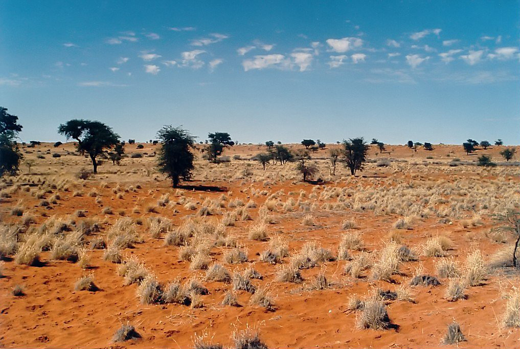
The Kalahari Desert (in Afrikaans: Kalahari-woestyn) is a large semi-arid sandy savannah in southern Africa extending 900,000 square kilometres (350,000 sq mi), covering much of Botswana, parts of Namibia, and regions of South Africa. A semi-desert, with huge tracts of excellent grazing after good rains, the Kalahari supports more animals and plants than a true desert, such as the Namib Desert to the west. There are small amounts of rainfall and the summer temperature is very high. The driest areas usually receive 110–200 millimetres of rain per year, and the wettest just a little over 500 millimetres (20 in). The surrounding Kalahari Basin covers over 2,500,000 square kilometres (970,000 sq mi) extending farther into Botswana, Namibia and South Africa, and encroaching into parts of Angola, Zambia and Zimbabwe. The Kalahari is home to many migratory birds and animals. Previously havens for wild animals from elephants to giraffes, and for predators such as lions and cheetahs, the riverbeds are now mostly grazing spots, though leopards and cheetahs can still be found. The area is now heavily grazed and cattle fences restrict the movement of wildlife. Among deserts of the Southern Hemisphere, the Kalahari most closely resembles some Australian deserts in its latitude and its mode of formation. The Kalahari Desert came into existence approximately sixty million years ago along with the formation of the African continent.

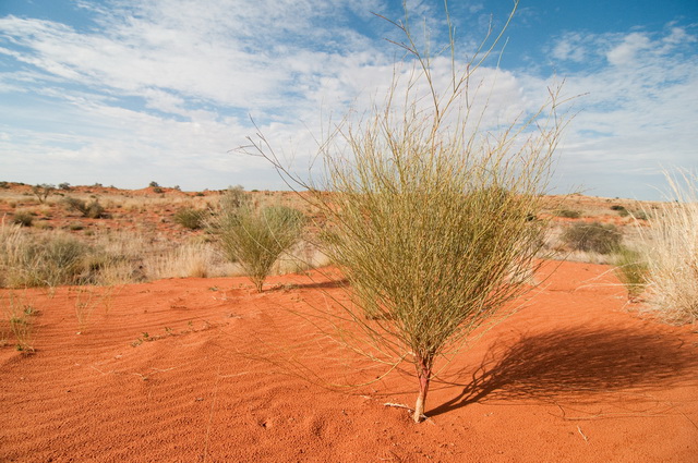
Derived from the Tswana word Kgala, meaning "the great thirst", or Kgalagadi, meaning "a waterless place", the Kalahari has vast areas covered by red sand without any permanent surface water. Drainage is by dry valleys, seasonally inundated pans, and the large salt pans of the Makgadikgadi Pan in Botswana and Etosha Pan in Namibia. The only permanent river, the Okavango, flows into a delta in the northwest, forming marshes that are rich in wildlife. Ancient dry riverbeds—called omuramba—traverse the central northern reaches of the Kalahari and provide standing pools of water during the rainy season.

Despite its aridity, the Kalahari supports a variety of flora. The native flora includes acacia trees and many other herbs and grasses. The kiwano fruit, also known as the horned melon, melano, African horned cucumber, jelly melon, or hedged gourd, is endemic to a region in the Kalahari Desert (specific region unknown).

Even where the Kalahari "desert" is dry enough to qualify as a desert in the sense of having low precipitation, it is not strictly speaking a desert because it has too dense a ground cover. The main region that lacks ground cover is in the southwest Kalahari (southeast of Namibia, northwest of South Africa and southwest of Botswana) in the south of the Kgalagadi Transfrontier Park. For instance in the ZF Mgcawu District Municipality of South Africa, total vegetation cover may be as low as 30.72% on non-protected (from cattle grazing) farmlands south of Twee Rivieren Rest Camp and 37.74% in the protected (from cattle grazing) South African side of the Kgalagadi Transfrontier Park: these southernmost Kalahari xeric savanna areas are truly semi-deserts. However, in all the remaining Kalahari, except on salt pans during the dry season, the vegetation cover can be clearly denser, up to almost 100% in some limited areas.

In an area of about 600,000 km2 in the south and west of the Kalahari, the vegetation is mainly xeric savanna. This area is the ecoregion identified by World Wide Fund for Nature as Kalahari xeric savanna. Typical savanna grasses include (Schmidtia, Stipagrostis, Aristida, and Eragrostis) interspersed with trees such as camelthorn (Acacia erioloba), grey camelthorn (Acacia haematoxylon), shepherd’s tree (Boscia albitrunca), blackthorn (Acacia mellifera), and silver cluster-leaf (Terminalia sericea).

In certain areas where the climate is drier, it becomes a true semi-desert with ground not entirely covered by vegetation: "open" as opposed to "closed" vegetation. Examples include the north of the Siyanda District, itself in the north of South Africa, and the Keetmanshoop Rural in the southeast of Namibia. In the north and east, there are dry forests covering an area of over 300,000 km2 in which Rhodesian teak and several species of acaciaare prominent.

Outside the Kalahari "desert", but in the Kalahari basin, a halophytic vegetation to the north is adapted to pans, lakes that are completely dry during the dry season, and maybe for years during droughts, such as in Etosha and Makgadikgadi

A totally different vegetation is adapted to the perennial fresh water of the Okavango Delta, an ecoregion termed.

Sunday, February 28, 2016

Macau

Macau, also spelled Macao, officially known as the Macao Special Administrative Region of the People's Republic of China, is a special administrative region on the southern coast of the People's Republic of China. Macau lies on the western side of the Pearl River Delta across from Hong Kong, which is about 64 kilometers to the east, and it is also bordered by Guangdong of Mainland China to the north and the South China Sea to the east and south. With an estimated population of around 636,200 living in an area of 30.3 km2 (11.6 sq mi), it is the most densely populated region in the world.

As Portuguese Macau, it was administered by the Portuguese Empire and its inheritor states from the mid-16th century until late 1999, when it was the last remaining European colony in Asia under Portugal. Portuguese traders first settled in Macau in the 1550s. In 1557, Macau was rented to Portugal from Ming China as a trading port. The Portuguese Empire administered the city under Chinese authority and sovereignty until 1887, when Macau became a colony. Sovereignty over Macau was transferred to China on 20 December 1999. The Joint Declaration on the Question of Macau and Macau Basic Law stipulate that Macau operate with a high degree of autonomy until at least 2049, fifty years after the transfer.

Under the policy of "one country, two systems", the State Council of the People's Republic of China is responsible for military defense and foreign affairs while Macau maintains its own legal system, the public security force, monetary system, customs policy, and immigration policy. Macau participates in many international organizations and events that do not require members to possess national sovereignty.

Macau is one of the world's richest cities, and as of 2013 its GDP per capita by purchasing power parity is higher than that of any country in the world, according to the World Bank. It became the world's largest gambling centre in 2006, with the economy heavily dependent on gambling and tourism, as well as manufacturing. Cantonese people from Hong Kong and Guangdong, in addition to the recent mainland tourism from Mandarin-speaking regions, have boosted the economy of Macau significantly. According to The World Factbook, Macau has the fourth highest life expectancy in the world. Moreover, it is one of only a few regions in Asia with a "very high Human Development Index", ranking 14th as of 2013.


Thursday, February 25, 2016

Hawaii

Hawaii is the 50th and most recent state of the United States of America, receiving statehood on August 21, 1959. Hawaii is the only U.S. state located in Oceania and the only one composed entirely of islands. It is the northernmost island group in Polynesia, occupying most of an archipelago in the central Pacific Ocean. Hawaii is the only U.S. state not located in the Americas. The state does not observe daylight saving time.
The state encompasses nearly the entire volcanic Hawaiian archipelago, which comprises hundreds of islands spread over 1,500 miles (2,400 km). At the southeastern end of the archipelago, the eight main islands are—in order from northwest to southeast: Niʻihau, Kauaʻi, Oʻahu, Molokaʻi, Lānaʻi, Kahoʻolawe, Maui and the Island of Hawaiʻi. The last is the largest island in the group; it is often called the "Big Island" or "Hawaiʻi Island" to avoid confusion with the state or archipelago. The archipelago is physiographically and ethnologically part of the Polynesian subregion of Oceania.
Hawaii's diverse natural scenery, warm tropical climate, abundance of public beaches, oceanic surroundings, and active volcanoes make it a popular destination for tourists, surfers, biologists, and volcanologists. Because of its central location in the Pacific and 19th-century labor migration, Hawaii's culture is strongly influenced by North American and Asian cultures, in addition to its indigenous Hawaiian culture. Hawaii has over a million permanent residents, along with many visitors and U.S. military personnel. Its capital is Honolulu on the island of Oʻahu.
Hawaii is the 8th-smallest and the 11th-least populous, but the 13th-most densely populated of the fifty U.S. states. It is the only state with an Asian plurality. The state's coastline is about 750 miles (1,210 km) long, thefourth longest in the U.S. after the coastlines of Alaska, Florida and California.
The Hawaiian islands were formed by volcanic activity initiated at an undersea magma source called the Hawaii hotspot. The process is continuing to build islands; the tectonic plate beneath much of the Pacific Ocean continually moves northwest and the hot spot remains stationary, slowly creating new volcanoes. Because of the hotspot's location, all currently active land volcanoes are located on the southern half of Hawaii Island. The newest volcano, Lōʻihi Seamount, is located south of the coast of Hawaii Island.
The last volcanic eruption outside Hawaii Island occurred at Haleakalā on Maui before the late 18th century, though it could have been hundreds of years earlier. In 1790, Kīlauea exploded; it was the deadliest eruption known to have occurred in the modern era in what is now the United States. Up to 5,405 warriors and their families marching on Kīlauea were killed by the eruption. Volcanic activity and subsequent erosion have created impressive geological features. Hawaii Island has the third-highest point among the world's islands.
On the flanks of the volcanoes, slope instability has generated damaging earthquakes and related tsunamis, particularly in 1868 and 1975. Steep cliffs have been created by catastrophic debris avalanches on the submerged flanks of ocean island volcanoes.


Sunday, February 21, 2016

Suez Canal

The Suez Canal is an artificial sea-level waterway in Egypt, connecting the Mediterranean Sea to the Red Sea through the Isthmus of Suez, and separates the African continent from Asia. After 10 years of construction, it was officially opened on November 17, 1869. The canal allows ships to travel between Europe and South Asia without navigating around Africa, thereby reducing the sea voyage distance by about 7,000 kilometres (4,300 mi). It extends from the northern terminus of Port Said to the southern terminus of Port Tewfik at the city of Suez. Its length is 193.30 km (120.11 mi), including its northern and southern access channels. In 2012, 17,225 vessels traversed the canal (47 per day).[1]
The canal is a single-lane waterway with passing locations in the Ballah Bypass and the Great Bitter Lake. It contains no locks system, with seawater flowing freely through it. In general, the canal north of the Bitter Lakes flows north in winter and south in summer. South of the lakes, the current changes with the tide at Suez.
The canal is owned and maintained by the Suez Canal Authority (SCA) of Egypt. Under the Convention of Constantinople, it may be used "in time of war as in time of peace, by every vessel of commerce or of war, without distinction of flag."
In August 2014, construction was launched to expand and widen the Ballah Bypass for 35 km (22 mi) to speed the canal's transit time. The expansion is expected to double the capacity of the Suez Canal from 49 to 97 ships a day. At a cost of $8.4 billion, this project was funded with interest-bearing investment certificates issued exclusively to Egyptian entities and individuals. The "New Suez Canal", as the expansion was dubbed, was opened with great fanfare in a ceremony on 6 August 2015.

Panama Canal

The Panamá Canal is a 48-mile (77 km) ship canal in Panama that connects the Atlantic Ocean (via the Caribbean Sea) to the Pacific Ocean. The canal cuts across the Isthmus of Panama and is a key conduit for international maritime trade. There are locks at each end to lift ships up to Gatun Lake, an artificial lake created to reduce the amount of excavation work required for the canal, 26 metres (85 ft) above sea level. The current locks are 33.5 metres (110 ft) wide. A third, wider lane of locks is currently under construction and is due to open in April of 2016.
France began work on the canal in 1881, but had to stop because of engineering problems and high mortality due to disease. The United States took over the project in 1904, and took a decade to complete the canal, which was officially opened on August 15, 1914. One of the largest and most difficult engineering projects ever undertaken, the Panama Canal shortcut greatly reduced the time for ships to travel between the Atlantic and Pacific Oceans, enabling them to avoid the lengthy, hazardous Cape Horn route around the southernmost tip of South America via the Drake Passage or Strait of Magellan. The shorter, faster, and safer route to the U.S. West Coast and to nations in and around the Pacific Ocean allowed those places to become more integrated with the world economy.
During construction, ownership of the territory that the Panama Canal now passes through was first Colombian, then French, and then American. The US continued to control the canal and surrounding Panama Canal Zone until the 1977 Torrijos–Carter Treaties provided for handover to Panama. After a period of joint American–Panamanian control, the canal was taken over by the Panamanian government in 1999, and is now managed and operated by the Panama Canal Authority, a Panamanian government agency.
Annual traffic has risen from about 1,000 ships in 1914, when the canal opened, to 14,702 vessels in 2008, the latter measuring a total of 309.6 million Panama Canal/Universal Measurement System (PC/UMS) tons. By 2008, more than 815,000 vessels had passed through the canal; the largest ships that can transit the canal today are called Panamax. It takes 6 to 8 hours to pass through the Panama Canal. The American Society of Civil Engineers has named the Panama Canal one of the seven wonders of the modern world.

Comments system

Disqus Shortname